Trails at Rocky Hill
Explore 3 miles of trails which lead through extensive woodlands to rocky ledges, beaver ponds, and large boulders. Trail conditions range from easy to moderate with some short steeper sections. Portions of the trail may be wet or muddy following heavy rainfall or spring thaw. Rocky surfaces may be slippery, due to water, wet leaves, and ice.
This sanctuary uses a blue/yellow trail marking system. Blue circle trail markers lead away from the parking lot. Yellow circle trail markers lead back to the parking lot.

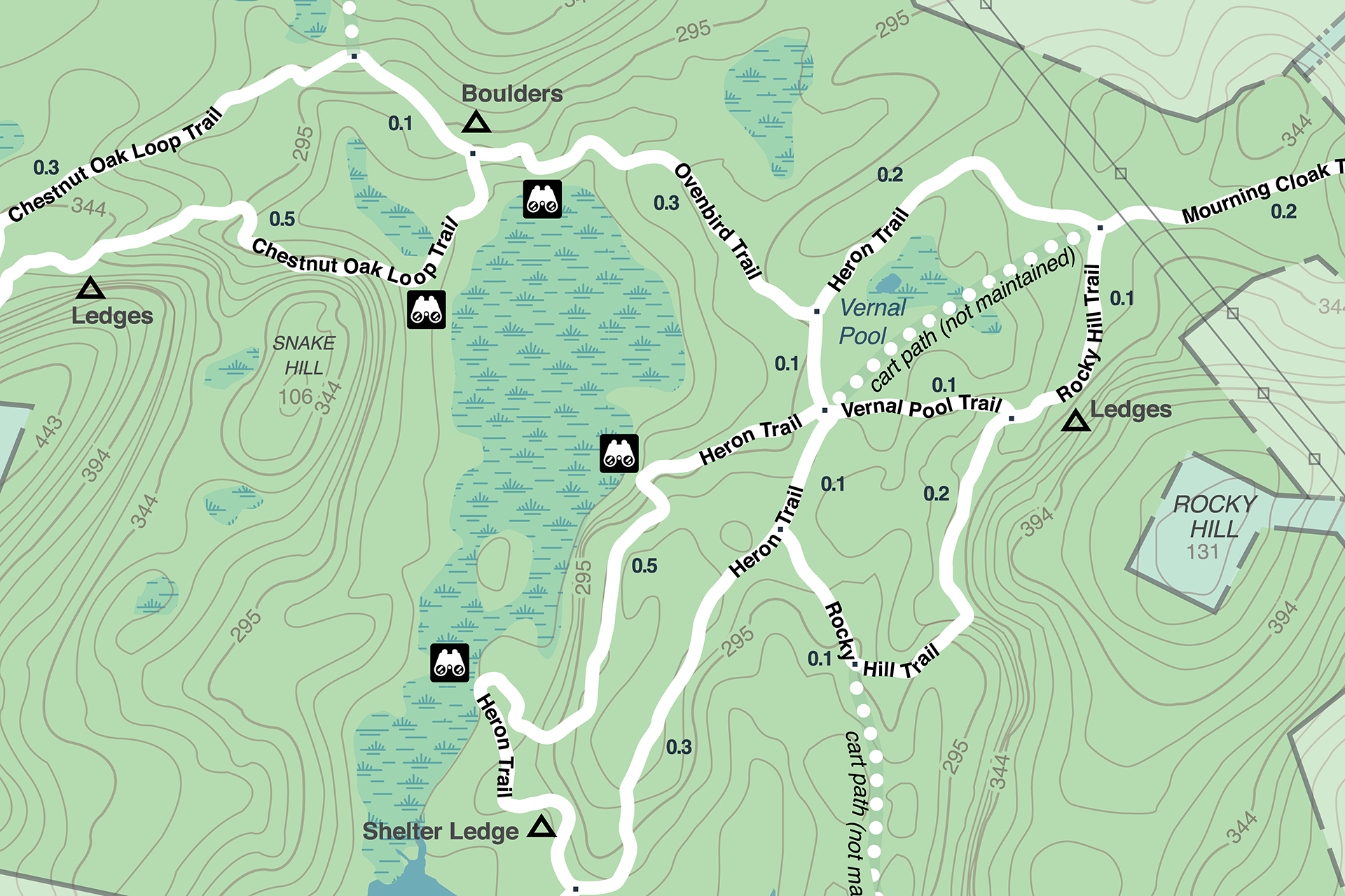
Digital Trail Map
Use your smartphone to navigate the sanctuary. View the map

Download the Trail Map
Trail Descriptions
Heronry Trail
Walk to a rocky outcrop that overlooks a beaver pond and provides a view of numerous great blue heron nests. The trail passes by an attractive rock shelter formed within a small ledge, and it then returns to a section of the old woodland road which leads back to the parking area or to the Rocky Hill Trail.
Rocky Hill Trail
Pass a rocky ridge and then to the base of Rocky Hill where you can enjoy the geology and topography of the sanctuary. Continue to the Heronry Trail to make an attractive loop.
Vernal Pool Trail
This trail is a short connector trail between the Heronry Trail and Rocky Hill Trail or is its own short loop trail. It passes a vernal pool that in early spring will be full of wood frogs but will usually be dry by early June.
Ovenbird Trail
This connector trail leads to the Snake Hill area of the sanctuary. View the north edge of the beaver dam from some of the shoreline or from a rocky outcrop.
Chestnut Oak Loop Trail
Take a long loop for a close look at the Snake Hill ledges where you can see rock tripe and rock polypody. At the far end of the trail look for chestnut oaks, a tree well adapted to the dry, sandy acidic soils. Reconnect to the Ovenbird Trail for the return trip.


