Broadmoor Wildlife Sanctuary
Trails at Broadmoor
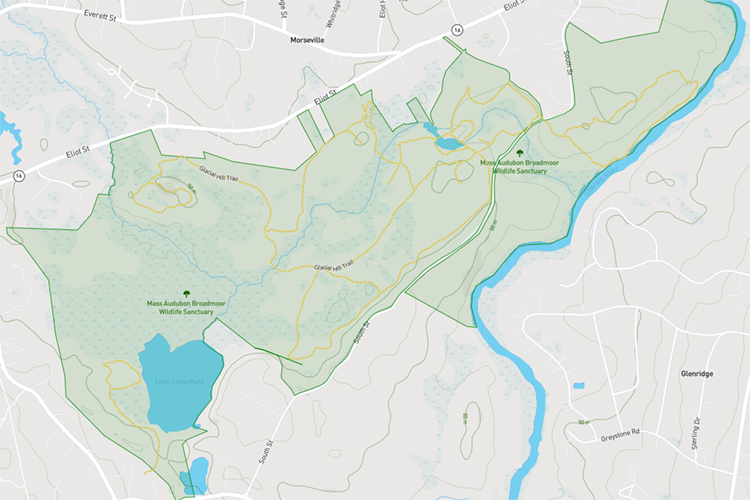
Explore 8 miles of trails at Broadmoor Wildlife Sanctuary, including a 0.6 mile universally accessible All Persons Trail. The trails are easy to rugged and lead you through the shade of mature woodlands into open fields and along the edges of streams, ponds, and marshland.
The trails are great pathways for birding, photography, and sketching. With the exception of the All Persons Trail, trails at Broadmoor have roots, rocks and rough terrain in some places.

Digital Trail Map
Use your smartphone to navigate the sanctuary. View the map

Download a Trail Map
Trail Descriptions
Mill Pond/Marsh Trail
Length: 0.4 miles
Details: Ponds, streams, marshes, and a seasonal waterfall make this trail a favorite of many visitors. You might glimpse a mink or muskrat at the water’s edge or spot a Lady’s-slipper orchid on the forest floor in spring or summer. A spur trail to the right at signpost 3 leads to a rock outcrop and bench, a great place to view the marsh. Mallards, Wood Ducks, Great Blue Herons, and Green Herons are often seen.
Old Orchard Trail
Length: 0.7 miles
Details: Start at the nature center, cross the main bridge, and go straight through the white pine forest. Go left at signpost 12 and continue to signpost 7. A spur trail to the right brings you to a field overlook with a 180 degree view of the fields and woods beyond. Nesting bluebirds, hunting foxes, and soaring red-tailed hawks might be seen in the open fields along this trail. Field sparrows and Indigo buntings may sing in nesting season. From signpost 7, go right along the Mill Lane and follow Old Orchard Trail along the edge of the woods with views of the fields looking north. At the end of the field Old Orchard Trail joins Quacking Frog Trail.
Indian Brook Trail
Length: 0.5 miles
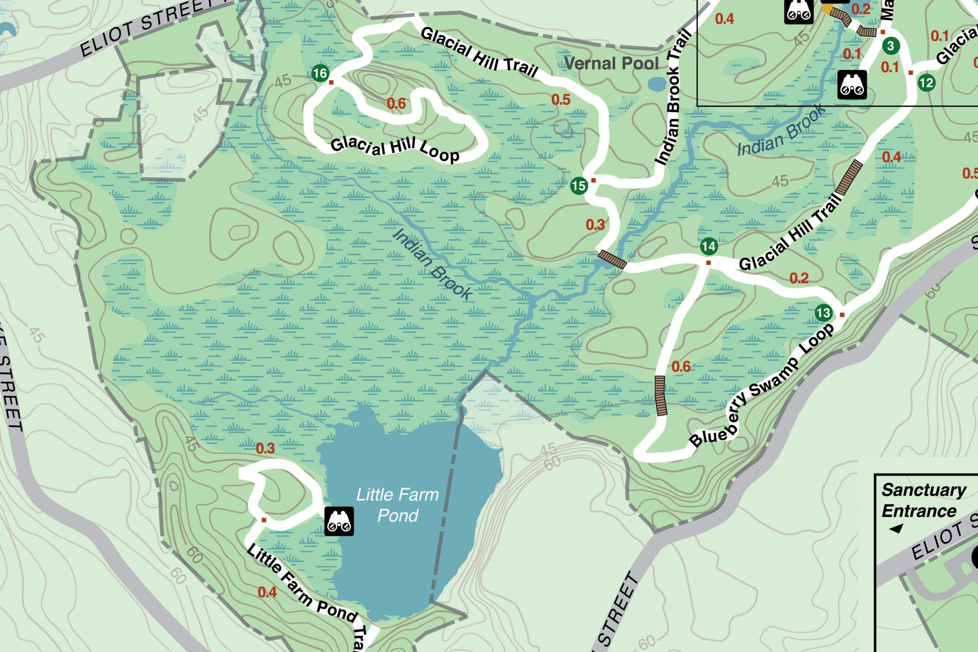
Details: The start of Indian Brook Trail passes open fields, drops down to a vernal pool overlook on the right, and then parallels Indian Brook through oak woods to Glacial Hill Trail at signpost 15. Go right at signpost 15 to continue on Glacial Hill Trail up to the Glacial Hill loop.
All Persons Trail
Length: 0.6 miles
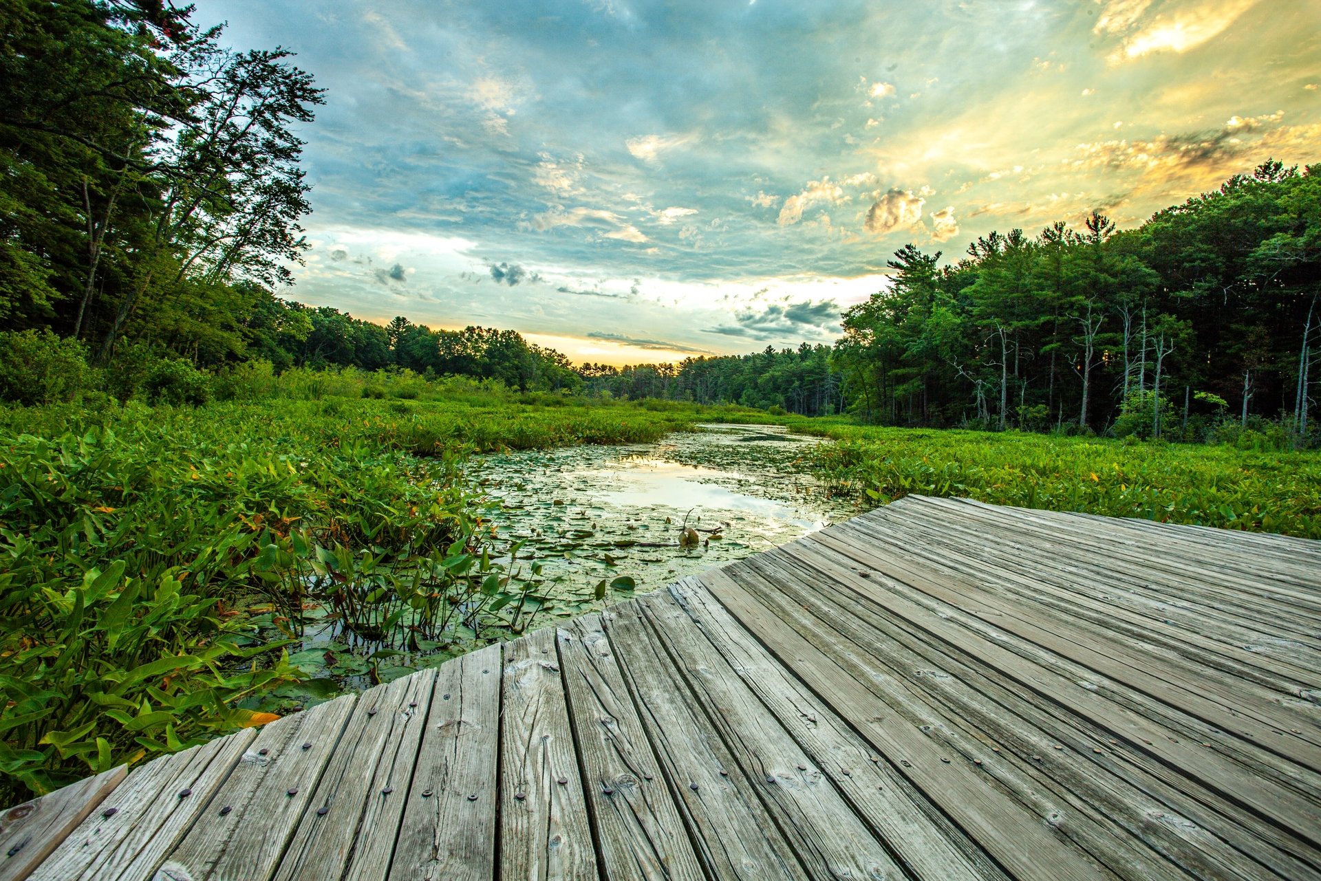
Details: This trail begins at the Nature Center and makes a switchback to the left includes a 430-foot boardwalk through the marsh, where visitors of all ages and abilities can observe the wetlands. Turtle watching is a favorite activity from late spring through early fall. Painted Turtles bask among lily pads and arrow arum. Continue right after the boardwalk to rejoin the main trail and take a spur to the left and up a slight slope to an outlook platform overlooking the field and woods. There are benches on either side of the platform. An audio tour accessible by cell phone interprets some of this walk during spring and fall. Learn more
Boundary Trail
Length: 0.5 miles
Details: From signpost 5 go left to cross over Indian Brook on an old cart road, continue to a sharp right turn through the woods with views of Wildlife Pond. Mature trees at the beginning sometimes attract Great Horned Owls in winter. The trail emerges from the woods with views of the field and Wildlife Pond beyond. This can be a good spot for birding the field edge and the pond. Look for great blue herons and wood ducks in the pond and northern cardinals, black-capped chickadees, white-breasted nuthatches, and the occasional northern mockingbird along the field edge.
Charles River Trail
Length: 1-mile loop
Details: Cross South Street to walk through white pines then continue left or right at signpost 11 for a loop along the Charles River. The trail has varied topography and drops down to follow the river for nearly half a mile. Cardinal flower blooms along the edge in summer and tupelos turn a burgundy color in fall. In winter, mixed flocks of ducks and geese may be seen. Away from the river, the trail continues through dry upland oak and pine forest where eastern towhees, wood thrushes, and eastern wood peewees may be heard in spring.
Glacial Hill Trail
Length: 1 mile
Details: The trail begins at signpost 15 and passes through pine/oak forest with marsh visible on the left. There is a rocky stretch of the trail just before signpost 16 the start of a 0.6 mile loop over a dry sandy ridge where shadbush blooms. In spring you may hear the quacking of wood frogs courting in two vernal pools below the trail. Little Farm Pond and extensive wetlands are visible to the south from several viewpoints. Look and listen for Wood Ducks and Osprey.
Hemlock Trail
Length: 0.2 miles
Details: Go right at signpost 5 and enter pine, oak, hemlock woods above the outlet of Indian Brook below the sawmill site. Drop down to the brook and go left to a viewpoint where ebony jewelwing damselflies can be seen in summer. Return to the main trail and follow the brook to the Wildlife Pond, spend some time looking for ducks, otters, and songbirds; then continue right along the outlet from the gristmill site to a massive rock outcrop.
Blueberry Swamp Trail
Length: 0.9 miles
Details: Fall is the best season to enjoy this loop around a red maple, blueberry, and larch swamp. Leaves turn color early and you may find birds feeding on seeds and berries in low sheltered spots.
Little Farm Pond Trail
Length: 0.7 miles
Details: This loop trail begins at a 3-car parking lot off Farm Road just east of the intersection with Lake Street in Sherborn. The loop trail takes you up to an overlook with a bench to observe the pond from above. Continue along the pond edge and look for ospreys, ring-necked ducks, red-tailed hawks, and pileated woodpeckers. In spring, listen for Virginia rails. A small area of northern bog can be found on the northern edge including sundews, pitcher plants, larch, red spruce, swamp milkweed, and poison sumac, but this area is only accessible by boat.
Please note: Fishing and boats are permitted on Little Farm Pond; boats must be carried in from the parking lot and not left on the property. Also, please follow blue and yellow blazes, which indicate a Broadmoor trail. A privately-owned trail does connect, but its not meant for public use.


