Important Bird Area Sites in Massachusetts
Important Bird Area: Bird Island
Site Summary
Nominated By
Ian Nisbet
Size
1.4 acres
Towns and Counties
Marion; Bristol County
Ownership
municipal
Major Habitats
10% salt marsh, 70% coastal beach, 20% marine/tidal
Land Use
nature & wildlife conservation/ land trust, other recreation or tourism, research
Serious Threats
excessive soil erosion/degradation
Minor Threats
predators
IBA Criteria
- Category 1: Sites important for long-term research and/or monitoring projects that contribute substantially to ornithology, bird conservation, and/or education.
- Category 4: Sites containing assemblages of species characteristic of a representative, rare, threatened, or unique habitat within the state or region.
- Category 5: Seabirds: The site regularly supports 300 or more pelagic seabirds and/or terns or 3,000 or more gulls at one time. A pelagic site is the actual location being used by seabirds (e.g., Stellwagen Bank) and not the location from which an observer counts seabirds (e.g., Provincetown). Smaller concentrations of less common gulls such as Laughing or Bonaparte's gullswill be considered. Human-made food sources for gulls such as landfills and sewage outflows will not be considered. The designation "seabirds" includes shearwaters, storm-petrels, fulmars, gannets, jaegers, and alcids.
Site Description
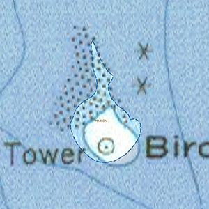
This island, located a half-mile south of Butler Point, Marion, is composed of eroded glacial till, protected by a riprap wall built in the 1830s; two seasonally flooded ponds; beach of gravel and shell; small areas of low-grade salt marsh; and other substrates including cobbles, boulders, and soil. In some areas there is a cover of herbaceous vegetation that grows as high as 6 or 7 feet tall in summer. The island is exposed to wave action from the southwest, and is washed over in hurricanes and occasional winter storms. A lighthouse is located at the highest point. It was decommissioned in the 1930s but reactivated by a local group in the 1990s.
Current Conservation Status
The island is subject to predation by Great Horned Owls from the mainland. It is also subject to predation by Great Black-backed Gulls, which take fledgling terns during July. The island has steadily eroded and has lost elevation over the past 30+ years, resulting in a loss of available nesting areas for terns. A proposal to reverse this process by covering low-lying parts of the island with dredge spoil has been put forward by state agencies, has been partly funding, and is wending its way through the regulatory process.
Ornithological Significance
Supports about 60% of the Massachusetts population of Roseate Terns (about 25% of continental population).
Supports about 20% of the Massachusetts population of Common Terns.
One of a small number of islands suitable for seabird nesting in southern Massachusetts (Buzzards Bay).
Long-term research program (32+ years) with ongoing intensive studies of both tern species, and many publications.
Other Flora or Fauna of Significance
None described.
Data Sources
None noted.


